
“Digital Archivist Note”

MapsAlive and Digital Archive
- Would items in your digital collection tell a better story if displayed on a map?
- Now there is a way to display historical items on a historical map of your choosing in conjunction with Digital Archive.
What if you wanted to show the houses that lined your town’s Main Street 100 years ago, or the boats that used to sail from a particular boathouse? Yes, admittedly, they could be marked on a modern map of the area. But that often doesn’t work. The roads have changed. There are other buildings where the historic ones once stood. Has that boathouse been changed into a condo?
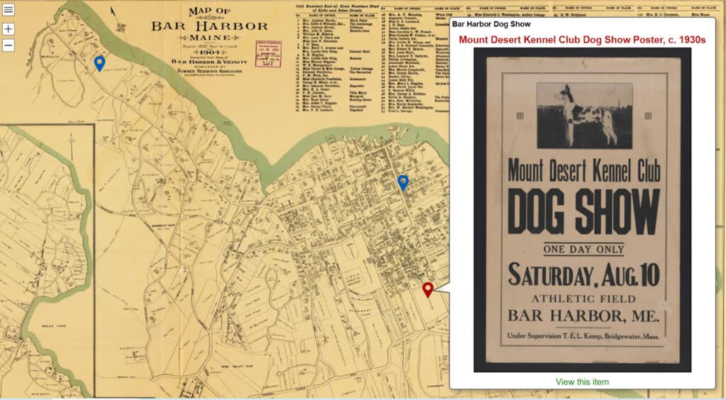
In May 2022 AvantLogic announced an integration between the Digital Archive and another AvantLogic product, MapsAlive. Unlike other mapping options, MapsAlive allows you to upload your own map image—an old city map from the 1886 Colby Atlas, a summer visitor map of Bar Harbor from 1904, an old blueprint, or even a floorplan of your museum.
You can then place links to items in your Digital Archive on the map. As users mouse over the links, images open in a window that contains a link back to your digital items.
For example, if you have a lot of images of historic buildings in your town you can display a map to show them in their proper locations, display images of them from your collection, and link directly back to your Digital Archive entries for further detail.
You can pan and zoom the maps, see a list of all the links provided, and even search that list.
What does it take to do this?
You install a plug-in on your Digital Archive site. It is a very simple install. The History Trust (Pauline) can help you with that.
- Subscribe to the MapsAlive software at mapsalive.com. Subscriptions range from $49 to $199 a year. The nonprofit price will be half of what’s quoted.
- Select the map/blueprint/design image you wish to use. Upload it to MapsAlive.
- Add a few lines of code to tell MapsAlive how to find your Digital Archive site. Add a few more to make the display look prettier.
- Enter the names of the links (called “Hotspots” in MapsAlive lingo) and add the Digital Archive Identifier number.
- Place the Hotspot on the map using a simple drag and drop.
- Preview your map.
- Click the button that publishes your map and assigns it a unique URL or web address. Use that address to allow anyone to see your custom map.
There is extensive documentation as you proceed, right in the MapsAlive software. And we (Pauline) can help you get set up and running.
Check out some examples.
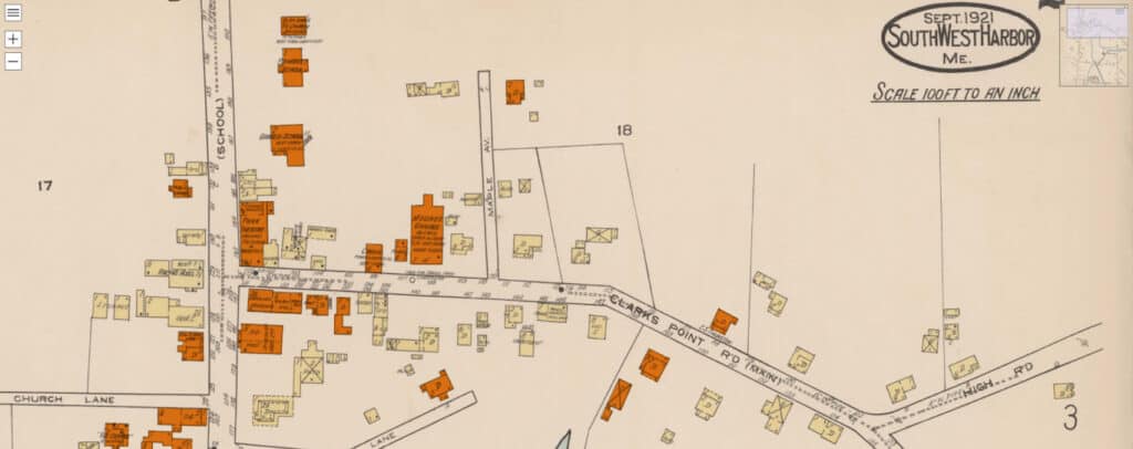
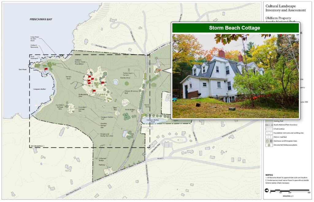
We created a few simple examples with materials in History Trust members’ Digital Archive collections. But also look at the ones MapsAlive prepared by Southwest Harbor Public Library. They are marvelous examples of what can be done when your digital collection is paired with MapsAlive.
- Great Harbor Maritime Museum – 1904 Bar Harbor map: https://tour.mapsalive.com/85062
- Gouldsboro Historical Society – 2004 Comprehensive Plan map: https://tour.mapsalive.com/85064
- Bar Harbor Historical Society –
- Old Farm National Park Service map: https://tour.mapsalive.com/85066
- 1916 Abbe model of MDI (photo): https://tour.mapsalive.com/85048
- Southwest Harbor Public Library –
- Sanborn 1922 map: https://mapsalive.com/samples/85023/?page=2
- Colby 1887 atlas: https://mapsalive.com/samples/85015/?page=1
- Southwest Harbor 2015 map: https://mapsalive.com/samples/85022/?page=1
- Acadia Bridges on a MapsAlive map (images and no links): https://tour.mapsalive.com/83670/?page=1
You can map anything! For instance, here are places Pauline has lived – United States map: https://tour.mapsalive.com/85067